My terrific collaborators at Herpetological Resource and Management put together this map of the Mudpuppy samples we have acquired so far from the Huron-Erie Corridor (St. Clair-Detroit River System) here in SE Michigan. Each yellow dot represents a capture record, for which we have a tissue sample. We never could have done this on our own, and owe a huge debt of gratitude to biologists at the U.S. Fish and Wildlife Service, U.S. Geological Survey, Michigan Department of Natural Resources, and Belle Isle Aquarium for their assistance!
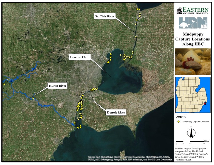 This is going to be an amazing dataset to look at gene flow among the lake and river systems, and to see whether things like surrounding landscape (and contaminant input) may be fragmenting populations. We also have a set of historic samples from the Detroit River, so we can see how effective population size has changed over time.
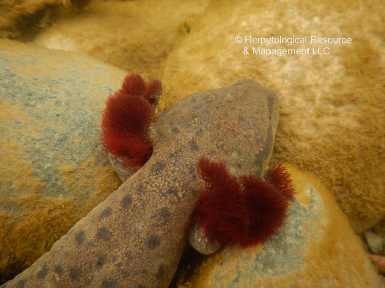
We’ve also made some terrific progress on the restoration side of the project, placing these structures at a number of sites to improve Mudpuppy habitat. They seem to work just as well in real life as they do in the adorable schematic drawing below. In fact, we’ve found Mudpuppies using these structures in as little as 48 hours after placement. Very exciting to be learning more about how to conserve these remarkable animals!


(Photos courtesy of HRM; artwork by Tricia Brockman)